Traditionally May is a tough month for me to get out. I have to contend with my Wife's busy season and thus I am on kid patrol nearly full time. In addition my climbing must contend with the hot spring fishing. Thankfully the kids are old enough to get out and wet their lines making the inability to get out much more tolerable. Since I have had an extended layoff I thought a big day was in order since I had the entire day to devote to it. Fletcher and I hatched a plan to knock of Eightmile via the less travelled SE route. I suspected the weather would not cooperate but Monday seemed nicer than what was predicted so I was hopeful when I went to sleep. I awoke to wind and pounding rain and suspected my plans would be foiled once again. I fell back to sleep and awoke just before my alarm was set at 4:45. The weather had not improved and when I saw that the area around Eighmile's summit was under a weather warning I called Fletcher to assesshis feelings. We both agreed that sleep sounded more fun than being blown around by 40mph+ gusts.
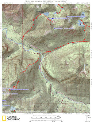
Thankfully I was able to get back to sleep and after attending to some needed things around home it was nearly 1pm. I hastily tried to pick something out that would fit for this day. I have wanted to explore the area around Hucklberry Mt. (Salmon La Sac) for some time and since it appeared to be mostly road walking I thought that it would work for this day. Thankfully the rain abated once I crested Snoqualmie Pass and I was able to make good time to the logging road that I wanted. I parked after about a half mile despite the fact I could have driven further without issue. After suiting up I made my way up the good logging road. I crossed Camp Creek on a bridge and came to an intersection. I saw one choice was a driveway and the other appeared to go towards the other side of the house. I took the road that was in the poorest shape. I could see that there had been foot traffic on it so I felt like I was heading in the right direction. Since I didn't think route finding was going to be an issue I left my map in my pack and was too lazy to consult it. Had I done so I would have noticed that I wasn't actually heading in the direction I wanted. I pushed on and soon was forced to cross one of the braids of Camp Creek on a suspect jumble of logs. Thankfully across the road degrade to more of a trail. Feeling I was off route, I contemplated turning back and getting back on track. My curiosity got the better of me and I wondered where the trail went to. The trail wasn't in the best shape but It did climb and that what I was most interested in.
The slope and brush were tolerable and the footing was loose but with the rain it was acceptable. I kept a good pace and crossed a few old roads in poor shape on my way to the snow line. So the grade backed off considerably and the snow deepened. I was concerned of getting off route on my way down so I tended to more open areas with recent snow making it easier to follow my tracks on the way out. Soon I reached an open area and I was able to see that I was due South of 6237' and just below the Hawkins Mt Massif. I was considerably SE of my intended target of Huckleberry Mt.and lacked any desire or time to traverse to the day's goal.

I was easily able to follow my ascent route and I enjoyed plunge stepping in the soft dirt on the way down. Soon I regained the original road and walked the spur that I thought went to the upper part of the house and realized that it was actually the road that I needed to reach Huckleberry's summit. I contemplated driving as far as I could to at least salvage a summit for this day. I instead thought it would be a fun family snowshoe when the kids are a bit older. It certainly was good to get out and the legs felt much stronger than what I had feared. It also appears that this route would be fun and direct way to reach Hawkins summit.


